
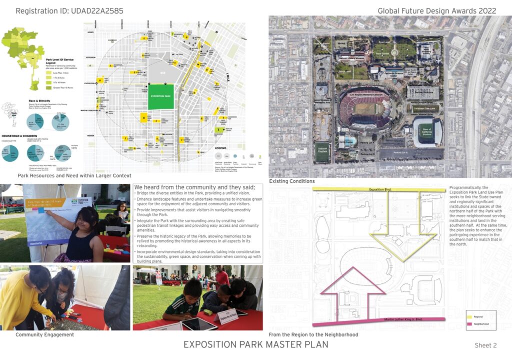
Situated on 152 acres, Exposition Park, is home to museums, sporting venues and community-serving recreational and educational facilities. However, since its founding as an agricultural fairground in 1882, the park has developed in a sporadic manner rendering many its facilities and green spaces disconnected from one another. Making matters worse most of the southern portion the site, (the area closest to one of the most park-poor and underserved communities in Los Angeles with less than 1-acre of parkland per 1,000 households.) is composed substantially of asphalt parking lots.
Urban Design & Architecture Design Awards 2023: Discounted Entries Open Now! Save $50
Super Early Discount – 1st May 2022 to 30th June 2022 – $199 = $149

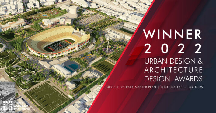
Gold 🏆 Winner
Urban Design & Architecture Design Awards 2022
Exposition Park Master Plan
Urban Design Concept
Firm
Torti Gallas + Partners
Architect/Designer
Neal Payton, FAIA, FCNU
Design Team
Torti Gallas + Partners, MIG, Gibson Transportation, Consensus, Sapphos Environmental, BRV, KPFF
Location
Los Angeles, California, USA
Country
United States
Photographer/Copyright
©Torti Gallas + Partners
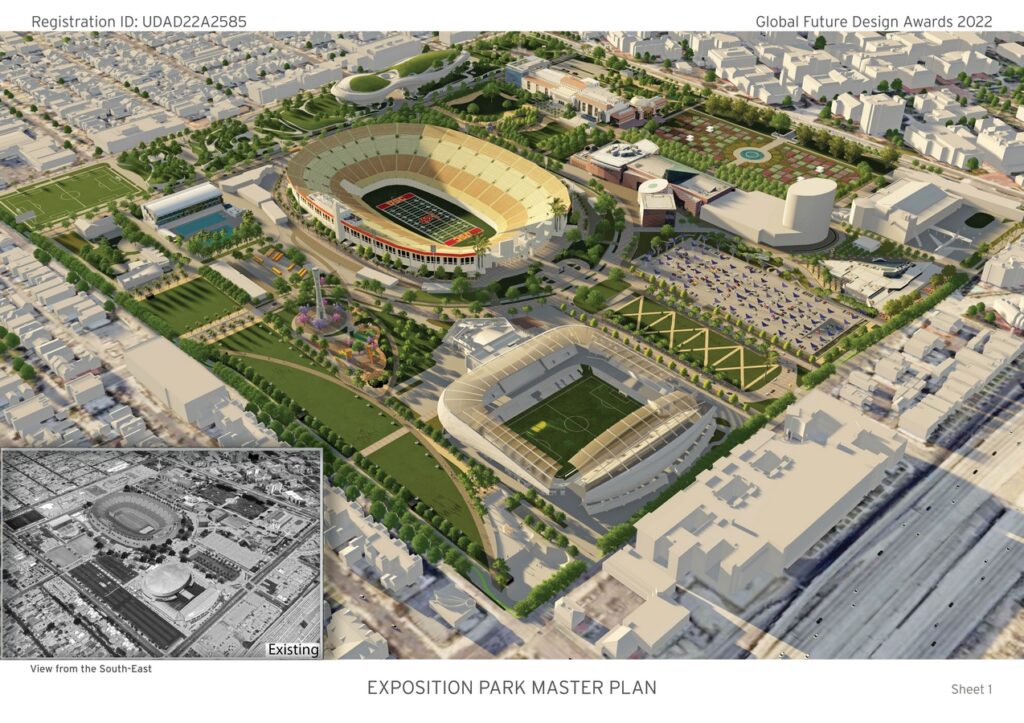


It is within this context that the master plan for the evolution of this State of California-owned facility for the next 25 years has been developed. Going forward, Exposition Park will be an example of the whole being greater than the sum of the parts. While each of its separate institutions have their own constituencies, it is the combination of these institutions, in harmony with one another and supplemented by a set of diverse landscapes, experiences and park-wide amenities that will make the park act and feel like an integral part of the local and regional community.
The Master Plan for identifies opportunities to make the facility more welcoming both to neighbors and visitors, including making it more accessible and easier to navigate. Located at an existing light rail station on the E-line and a future BRT station on the planned Vermont Avenue route, the park includes a robust strategy for managing and directing pedestrians and encouraging micro-mobility access. Ensuring public access to natural, historical and cultural resources is one of the State’s top priorities, along with achieving climate resiliency and increasing awareness of biodiversity. The Master Plan is designed to be aligned with these priorities.
Created in close consultation with the surrounding community the Master Plan specifically addresses the community’s concerns related to the disparity of park space between the north and south side of the park, the latter of which is closest to residential neighborhood and dominated by surface parking lots. This represents a significant contrast to the north side which is green and park-like. To address this inequity the Plan links the regionally significant institutions and historic spaces of the northern half of the Park with the more neighborhood serving institutions in the southern half. At the same time, the plan seeks to enhance the park-going experience in the lower half to match that in the north by consolidating the surface parking that dominates the southern half of the Park into an underground garage. This will free up land to create additional park spaces, which will serve both the local community and Park visitors from the region and beyond.
Key features:
- Relocation of surface parking to a below-ground parking structure and increasing usable park space from 37% of the total park area to 48% of the total. This change is particularly significant in the southern portion of the park, which is closest to residents of the community.
- Creation of a unified Park — connecting its facilities to one another by improving pedestrian and recreational use of the spaces between buildings and undergrounding parking.
- Plentiful pathways, landscape, and visitor amenities to improve the experience of community members and visitors coming to the park.
- Improved access for all, sustainability, and equity while preserving Exposition park as a public and historic resource.
- Improves ADA accessibility throughout the Park campus.
- Creates new gateway entries to the Park.
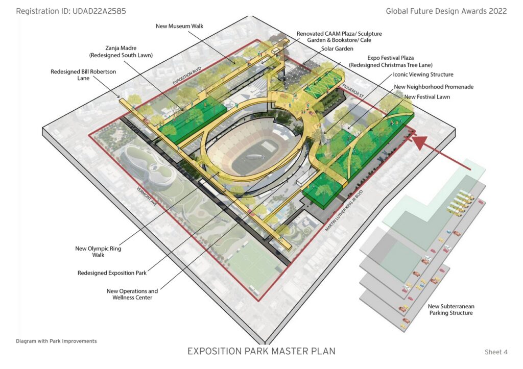
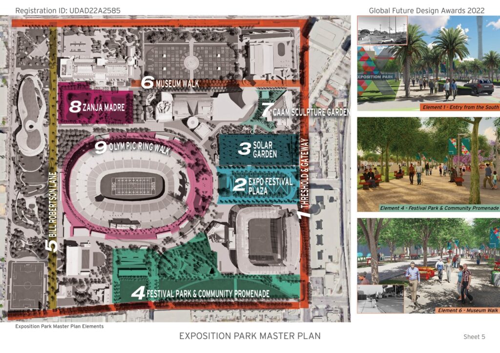
Master Plan Elements
To spread the fund-raising net as wide as possible, the master plan has designed as nine-distinct projects that will complement the Park’s existing facilities – linking them together with a comprehensive pedestrian circulation and wayfinding system.
The new or re-configured park spaces are conceived to add to the types of spaces contained in the park. For example, the “Zanja Madre” is a reconfiguration of an existing but underutilized lawn into an educational garden, with a focus on sustainability whose design will celebrate the aqueduct system that first brought water to the Los Angles pueblo.
Along the park’s southern edge will lie the 14.2-acre “Festival Park and promenade”, a casual space, allowing for a range of informal activities and gatherings to highly programmed events. Other new park elements serve to add clarity and amenity to the pedestrian’s path of travel. For example, “Museum Walk” is a reconfiguration of existing State Drive, which will link the Park’s four-museums in a pedestrian prioritized experience
“Olympic ring Walk” celebrates the sports history of the park particularly as related to the Coliseum. The plan also transforms Christmas tree Lane into “Expo Festival plaza”, a more accessible and usable open space that preserves its historic view corridor. The plan contemplates a bookstore or café within the California African American Museum’s plaza and an outdoor sculpture garden.
Another component of the plan includes the transformation of Bill Robertson Lane into a more “complete street” welcoming pedestrians, bicycles and vehicles alike through new landscape and special paving. A protected bike path has also been anticipated to run along Exposition Boulevard, Figueroa street and martin Luther king, Jr. Boulevard.